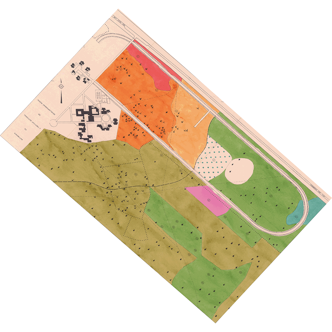
Étude pédologique du domaine de l'Institut National de Développement Rural (Thiès). Scale of 1:2 000 to 1:1 400. Date of publication: 1983.
1. Carte de végétation : étude pédologique du domaine de l'Institut National de Développement Rural (Thiès). / Bernhard Reversat, France; Cissé, A. N. (ill.); Scale of 1:2 000. Date of publication: 1983. (file: 02330RC_IRD_SEN_VEGE_1983_2000_IRD_SEN_CSRE_1983_2000-1400.tif) 2. Carte factorielle : étude pédologique du domaine de l'Institut National de Développement Rural (Thiès). / Zante, Patrick; Cissé, A. N. (ill.); Scale of 1:1 400. Date of publication: 1983. (file: 02331RC_IRD_SEN_PEDO_1983_1400_IRD_SEN_CSRE_1983_2000-1400.tif) 3. Carte pédologique : étude pédologique du domaine de l'Institut National de Développement Rural (Thiès). / Zante, Patrick; Cissé, A. N. (ill.); Scale of 1:1 400. Date of publication: 1983. (file: 02329RC_IRD_SEN_PEDO_1983_1400_IRD_SEN_CSRE_1983_2000-1400.tif)
Overview
Lineage
2. Georeferencing and if possible reprojection to WGS84 (Longitude / Latitude).
3. Clipping and mosaicing of map sheets(s).
4. Export ECW format.
5. ECW to GeoTIFF format conversion.
Links
Downloads
- sphaera_ws:02330RC_IRD_SEN_VEGE_1983_2000_IRD_SEN_CSRE_1983_2000-1400 Carte de végétation : étude pédologique du domaine de l'Institut National de Développement Rural (Thiès).
- link
- sphaera_ws:02331RC_IRD_SEN_PEDO_1983_1400_IRD_SEN_CSRE_1983_2000-1400 Carte factorielle : étude pédologique du domaine de l'Institut National de Développement Rural (Thiès).
- Télécharger au format GeoTIFF Télécharger au format GeoTIFF
- sphaera_ws:02329RC_IRD_SEN_PEDO_1983_1400_IRD_SEN_CSRE_1983_2000-1400 Carte pédologique : étude pédologique du domaine de l'Institut National de Développement Rural (Thiès).
- Télécharger au format GeoTIFF Télécharger au format GeoTIFF
Geolinks
- sphaera_ws:02330RC_IRD_SEN_VEGE_1983_2000_IRD_SEN_CSRE_1983_2000-1400 Carte de végétation : étude pédologique du domaine de l'Institut National de Développement Rural (Thiès).
- sphaera_ws:02331RC_IRD_SEN_PEDO_1983_1400_IRD_SEN_CSRE_1983_2000-1400 Carte factorielle : étude pédologique du domaine de l'Institut National de Développement Rural (Thiès).
- sphaera_ws:02329RC_IRD_SEN_PEDO_1983_1400_IRD_SEN_CSRE_1983_2000-1400 Carte pédologique : étude pédologique du domaine de l'Institut National de Développement Rural (Thiès).
Others
- Notice explicative ou autre ouvrage Document associé à la carte
- Link to Original Record [datasuds-geo.ird.fr] This metadata comes from datasuds-geo.ird.fr
- Notice explicative ou autre ouvrage Document associé à la carte
- Notice explicative ou autre ouvrage Document associé à la carte
- Digital Object Identifier (DOI)