Carte géologique des trois Guyanes = Geological map of three Guianas. Scale of 1:2 000 000. Date of publication: 1952.
IDS IRD
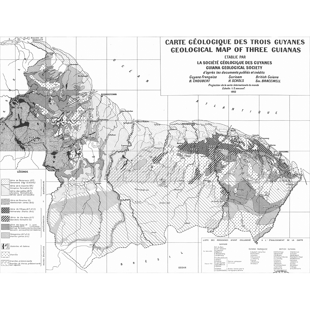
1. Carte géologique des trois Guyanes = Geological map of three Guianas. / Suarès, M. (cartogr.); Lahorgue, G. (ill.); Scale of 1:2 000 000. Date of publication: 1952. (file: 05544RC_IRD_-AS_GEOL_1952_2000000_IRD_-AS_GEOL_1952_2000000.tif)
publicationDec 31, 1951
Temporal CoverageJan 1, 1952Dec 31, 1952
Overview
1 / 2
Lineage
1. Scanning to tif format, 256 colors, 250dpi.
2. Georeferencing and if possible reprojection to WGS84 (Longitude / Latitude).
3. Clipping and mosaicing of map sheets(s).
4. Export ECW format.
5. ECW to GeoTIFF format conversion.
2. Georeferencing and if possible reprojection to WGS84 (Longitude / Latitude).
3. Clipping and mosaicing of map sheets(s).
4. Export ECW format.
5. ECW to GeoTIFF format conversion.
Links
Downloads
- sphaera_ws:05544RC_IRD_-AS_GEOL_1952_2000000_IRD_-AS_GEOL_1952_2000000 Carte géologique des trois Guyanes = Geological map of three Guianas.
- link
Geolinks
- sphaera_ws:05544RC_IRD_-AS_GEOL_1952_2000000_IRD_-AS_GEOL_1952_2000000 Carte géologique des trois Guyanes = Geological map of three Guianas.
Others
- Link to Original Record [datasuds-geo.ird.fr] This metadata comes from datasuds-geo.ird.fr
- Digital Object Identifier (DOI)
Keywords
Constraints
licence
Use limitations
Licence : CC-BY-NC-SA