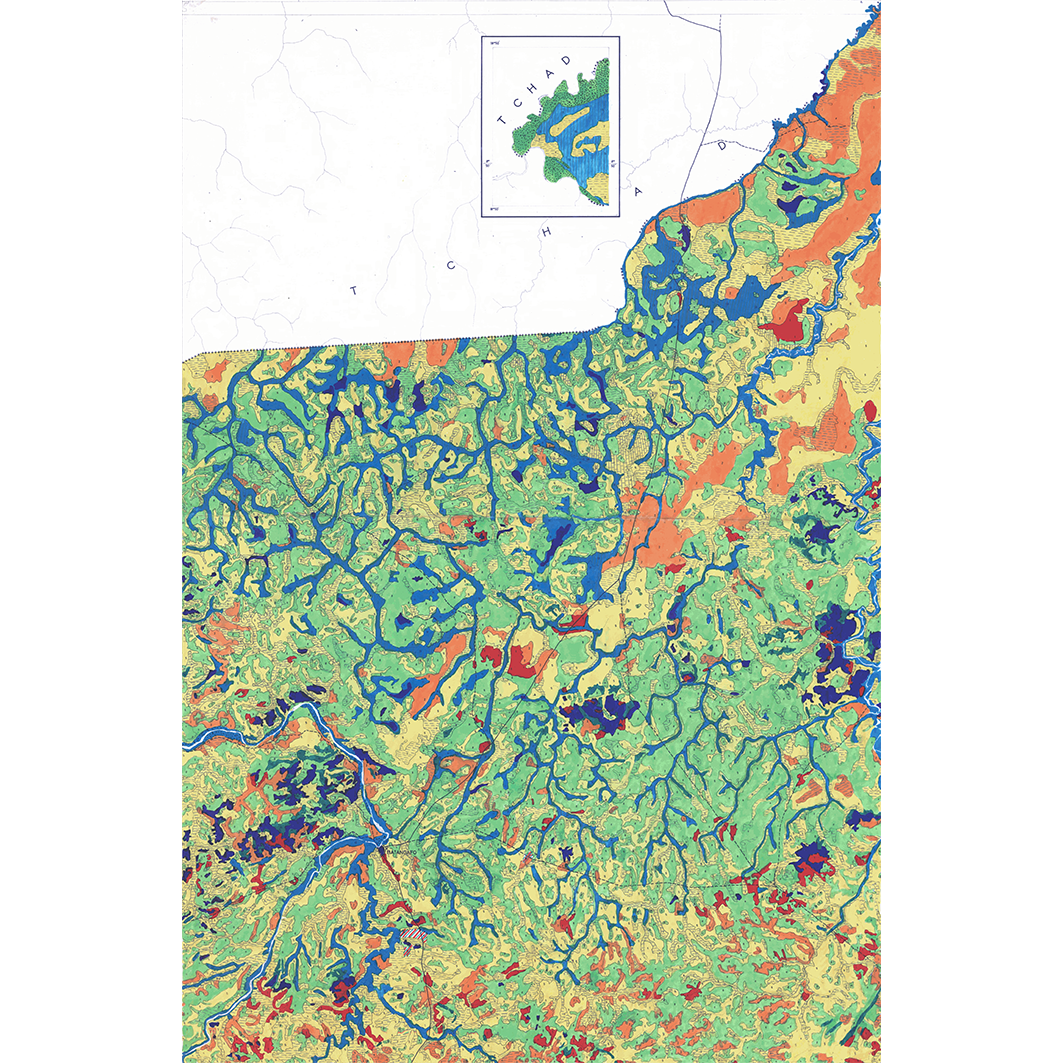
Carte des contraintes édaphiques de la République Centrafricaine. Scale of 1:200 000. Date of publication: 1977-1980.
1. Carte des contraintes édaphiques de l'Empire Centrafricain : Batangafo (Ouham). / Cointepas, J. P.; Scale of 1:200 000. Date of publication: 1978. (file: 01513RC_IRD_CAF_PECE_1978_200000_IRD_CAF_PECE_1977-80_200000.tif) 2. Carte des contraintes édaphiques de l'Empire Centrafricain : Bossangoa (Ouham). / Cointepas, J. P.; Scale of 1:200 000. Date of publication: 1977. (file: 01526RC_IRD_CAF_PECE_1977_200000_IRD_CAF_PECE_1977-80_200000.tif) 3. Carte des contraintes édaphiques de l'Empire Centrafricain : Bouca (Ouham). / Cointepas, J. P.; Scale of 1:200 000. Date of publication: 1978. (file: 01533RC_IRD_CAF_PECE_1978_200000_IRD_CAF_PECE_1977-80_200000.tif) 4. Carte des contraintes édaphiques de l'Empire Centrafricain : Kaga Bandoro (Gribingui économique). / Cointepas, J. P.; Scale of 1:200 000. Date of publication: 1979. (file: 01549RC_IRD_CAF_PECE_1979_200000_IRD_CAF_PECE_1977-80_200000.tif) 5. Carte des contraintes édaphiques de l'Empire Centrafricain : Kouki (Ouham). / Cointepas, J. P.; Scale of 1:200 000. Date of publication: 1978. (file: 01550RC_IRD_CAF_PECE_1978_200000_IRD_CAF_PECE_1977-80_200000.tif) 6. Carte des contraintes édaphiques de la République Centrafricaine : Bambari. / Cointepas, J. P.; Scale of 1:200 000. Date of publication: 1980. (file: 01497RC_IRD_CAF_PECE_1980_200000_IRD_CAF_PECE_1977-80_200000.tif) 7. Carte des contraintes édaphiques de la République Centrafricaine : Bangui. / Cointepas, J. P.; Scale of 1:200 000. Date of publication: 1980. (file: 01507RC_IRD_CAF_PECE_1980_200000_IRD_CAF_PECE_1977-80_200000.tif) 8. Carte des contraintes édaphiques de la République Centrafricaine : Bianga. / Cointepas, J. P.; Scale of 1:200 000. Date of publication: 1980. (file: 01518RC_IRD_CAF_PECE_1980_200000_IRD_CAF_PECE_1977-80_200000.tif)
Overview
Lineage
2. Georeferencing and if possible reprojection to WGS84 (Longitude / Latitude).
3. Clipping and mosaicing of map sheets(s).
4. Export ECW format.
5. ECW to GeoTIFF format conversion.
Links
Downloads
- sphaera_ws:01513RC_IRD_CAF_PECE_1978_200000_IRD_CAF_PECE_1977-80_200000 Carte des contraintes édaphiques de l'Empire Centrafricain : Batangafo (Ouham).
- link
- sphaera_ws:01526RC_IRD_CAF_PECE_1977_200000_IRD_CAF_PECE_1977-80_200000 Carte des contraintes édaphiques de l'Empire Centrafricain : Bossangoa (Ouham).
- Télécharger au format GeoTIFF Télécharger au format GeoTIFF
- sphaera_ws:01533RC_IRD_CAF_PECE_1978_200000_IRD_CAF_PECE_1977-80_200000 Carte des contraintes édaphiques de l'Empire Centrafricain : Bouca (Ouham).
- Télécharger au format GeoTIFF Télécharger au format GeoTIFF
- sphaera_ws:01549RC_IRD_CAF_PECE_1979_200000_IRD_CAF_PECE_1977-80_200000 Carte des contraintes édaphiques de l'Empire Centrafricain : Kaga Bandoro (Gribingui économique).
- Télécharger au format GeoTIFF Télécharger au format GeoTIFF
- sphaera_ws:01550RC_IRD_CAF_PECE_1978_200000_IRD_CAF_PECE_1977-80_200000 Carte des contraintes édaphiques de l'Empire Centrafricain : Kouki (Ouham).
- Télécharger au format GeoTIFF Télécharger au format GeoTIFF
- sphaera_ws:01497RC_IRD_CAF_PECE_1980_200000_IRD_CAF_PECE_1977-80_200000 Carte des contraintes édaphiques de la République Centrafricaine : Bambari.
- Télécharger au format GeoTIFF Télécharger au format GeoTIFF
- sphaera_ws:01507RC_IRD_CAF_PECE_1980_200000_IRD_CAF_PECE_1977-80_200000 Carte des contraintes édaphiques de la République Centrafricaine : Bangui.
- Télécharger au format GeoTIFF Télécharger au format GeoTIFF
- sphaera_ws:01518RC_IRD_CAF_PECE_1980_200000_IRD_CAF_PECE_1977-80_200000 Carte des contraintes édaphiques de la République Centrafricaine : Bianga.
- Télécharger au format GeoTIFF Télécharger au format GeoTIFF
Geolinks
- sphaera_ws:01513RC_IRD_CAF_PECE_1978_200000_IRD_CAF_PECE_1977-80_200000 Carte des contraintes édaphiques de l'Empire Centrafricain : Batangafo (Ouham).
- sphaera_ws:01526RC_IRD_CAF_PECE_1977_200000_IRD_CAF_PECE_1977-80_200000 Carte des contraintes édaphiques de l'Empire Centrafricain : Bossangoa (Ouham).
- sphaera_ws:01533RC_IRD_CAF_PECE_1978_200000_IRD_CAF_PECE_1977-80_200000 Carte des contraintes édaphiques de l'Empire Centrafricain : Bouca (Ouham).
- sphaera_ws:01549RC_IRD_CAF_PECE_1979_200000_IRD_CAF_PECE_1977-80_200000 Carte des contraintes édaphiques de l'Empire Centrafricain : Kaga Bandoro (Gribingui économique).
- sphaera_ws:01550RC_IRD_CAF_PECE_1978_200000_IRD_CAF_PECE_1977-80_200000 Carte des contraintes édaphiques de l'Empire Centrafricain : Kouki (Ouham).
- sphaera_ws:01497RC_IRD_CAF_PECE_1980_200000_IRD_CAF_PECE_1977-80_200000 Carte des contraintes édaphiques de la République Centrafricaine : Bambari.
- sphaera_ws:01507RC_IRD_CAF_PECE_1980_200000_IRD_CAF_PECE_1977-80_200000 Carte des contraintes édaphiques de la République Centrafricaine : Bangui.
- sphaera_ws:01518RC_IRD_CAF_PECE_1980_200000_IRD_CAF_PECE_1977-80_200000 Carte des contraintes édaphiques de la République Centrafricaine : Bianga.
Others
- Link to Original Record [datasuds-geo.ird.fr] This metadata comes from datasuds-geo.ird.fr
- Digital Object Identifier (DOI)