Atlas régional Sud-Est. Scale of 1:1 150 000 to 1:500 000. Date of publication: 1968-1969.
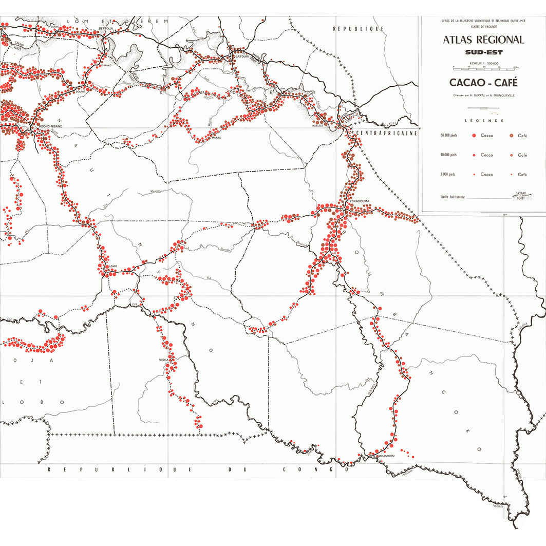
1. Cacao - café. / Barral, Henri; Franqueville, A.; Scale of 1:500 000. Date of publication: 1968. (file: 02968RC_IRD_CMR_AGCU_1968_500000_IRD_CMR_AAAA_1968-69_1150000-500000.tif) 2. Carte repère. / Franqueville, A.; Zoa, J. (ill.); Scale of 1:500 000. Date of publication: 1969. (file: 02970RC_IRD_CMR_ILSI_1969_500000_IRD_CMR_AAAA_1968-69_1150000-500000.tif) 3. Cultures industrielles. / Barral, Henri; Franqueville, A.; Scale of 1:1 150 000. Date of publication: 1969. (file: 02222RC_IRD_CMR_AGCU_1969_1150000_IRD_CMR_AAAA_1968-69_1150000-500000.tif) 4. Densités. / Franqueville, A.; Scale of 1:500 000. Date of publication: 1968. (file: 02965RC_IRD_CMR_PODE_1968_500000_IRD_CMR_AAAA_1968-69_1150000-500000.tif) 5. Infrastructure. / Barral, Henri; Boulet, J.; Courade, Georges; Franqueville, A.; Séguin, L. (ill.); Scale of 1:500 000. Date of publication: 1968. (file: 02967RC_IRD_CMR_INFR_1968_500000_IRD_CMR_AAAA_1968-69_1150000-500000.tif) 6. L'exploitation agricole. / Barral, Henri; Franqueville, A.; Scale of 1:1 150 000. Date of publication: 1969. (file: 02223RC_IRD_CMR_AGEX_1969_1150000_IRD_CMR_AAAA_1968-69_1150000-500000.tif) 7. Le bois : permis d'exploitation et de recherche : 30. / Barral, Henri; Franqueville, A.;6.1967. Scale of 1:1 150 000. Date of publication: 1969. (file: 02224RC_IRD_CMR_AGFO_1969_1150000_IRD_CMR_AAAA_1968-69_1150000-500000.tif) 8. Populations. / Barral, Henri; Boulet, J.; Franqueville, A.; Séguin, L. (ill.); Scale of 1:500 000. Date of publication: 1968. (file: 02966RC_IRD_CMR_POPU_1968_500000_IRD_CMR_AAAA_1968-69_1150000-500000.tif) 9. Tabac de cape : sud-est et est 2. / Franqueville, A.; Scale of 1:500 000. Date of publication: 1968. (file: 02969RC_IRD_CMR_AGCU_1968_500000_IRD_CMR_AAAA_1968-69_1150000-500000.tif) 10. Zones homogènes. / Barral, Henri; Franqueville, A.; Scale of 1:1 150 000. Date of publication: 1969. (file: 02221RC_IRD_CMR_AGRO_1969_1150000_IRD_CMR_AAAA_1968-69_1150000-500000.tif)
Overview
Lineage
2. Georeferencing and if possible reprojection to WGS84 (Longitude / Latitude).
3. Clipping and mosaicing of map sheets(s).
4. Export ECW format.
5. ECW to GeoTIFF format conversion.
Links
Downloads
- sphaera_ws:02968RC_IRD_CMR_AGCU_1968_500000_IRD_CMR_AAAA_1968-69_1150000-500000 Cacao - café.
- link
- sphaera_ws:02970RC_IRD_CMR_ILSI_1969_500000_IRD_CMR_AAAA_1968-69_1150000-500000 Carte repère.
- Télécharger au format GeoTIFF Télécharger au format GeoTIFF
- sphaera_ws:02222RC_IRD_CMR_AGCU_1969_1150000_IRD_CMR_AAAA_1968-69_1150000-500000 Cultures industrielles.
- Télécharger au format GeoTIFF Télécharger au format GeoTIFF
- sphaera_ws:02965RC_IRD_CMR_PODE_1968_500000_IRD_CMR_AAAA_1968-69_1150000-500000 Densités.
- Télécharger au format GeoTIFF Télécharger au format GeoTIFF
- sphaera_ws:02967RC_IRD_CMR_INFR_1968_500000_IRD_CMR_AAAA_1968-69_1150000-500000 Infrastructure.
- Télécharger au format GeoTIFF Télécharger au format GeoTIFF
- sphaera_ws:02223RC_IRD_CMR_AGEX_1969_1150000_IRD_CMR_AAAA_1968-69_1150000-500000 L'exploitation agricole.
- Télécharger au format GeoTIFF Télécharger au format GeoTIFF
- sphaera_ws:02224RC_IRD_CMR_AGFO_1969_1150000_IRD_CMR_AAAA_1968-69_1150000-500000 Le bois : permis d'exploitation et de recherche : 30.
- Télécharger au format GeoTIFF Télécharger au format GeoTIFF
- sphaera_ws:02966RC_IRD_CMR_POPU_1968_500000_IRD_CMR_AAAA_1968-69_1150000-500000 Populations.
- Télécharger au format GeoTIFF Télécharger au format GeoTIFF
- sphaera_ws:02969RC_IRD_CMR_AGCU_1968_500000_IRD_CMR_AAAA_1968-69_1150000-500000 Tabac de cape : sud-est et est 2.
- Télécharger au format GeoTIFF Télécharger au format GeoTIFF
- sphaera_ws:02221RC_IRD_CMR_AGRO_1969_1150000_IRD_CMR_AAAA_1968-69_1150000-500000 Zones homogènes.
- Télécharger au format GeoTIFF Télécharger au format GeoTIFF
Geolinks
- sphaera_ws:02968RC_IRD_CMR_AGCU_1968_500000_IRD_CMR_AAAA_1968-69_1150000-500000 Cacao - café.
- sphaera_ws:02970RC_IRD_CMR_ILSI_1969_500000_IRD_CMR_AAAA_1968-69_1150000-500000 Carte repère.
- sphaera_ws:02222RC_IRD_CMR_AGCU_1969_1150000_IRD_CMR_AAAA_1968-69_1150000-500000 Cultures industrielles.
- sphaera_ws:02965RC_IRD_CMR_PODE_1968_500000_IRD_CMR_AAAA_1968-69_1150000-500000 Densités.
- sphaera_ws:02967RC_IRD_CMR_INFR_1968_500000_IRD_CMR_AAAA_1968-69_1150000-500000 Infrastructure.
- sphaera_ws:02223RC_IRD_CMR_AGEX_1969_1150000_IRD_CMR_AAAA_1968-69_1150000-500000 L'exploitation agricole.
- sphaera_ws:02224RC_IRD_CMR_AGFO_1969_1150000_IRD_CMR_AAAA_1968-69_1150000-500000 Le bois : permis d'exploitation et de recherche : 30.
- sphaera_ws:02966RC_IRD_CMR_POPU_1968_500000_IRD_CMR_AAAA_1968-69_1150000-500000 Populations.
- sphaera_ws:02969RC_IRD_CMR_AGCU_1968_500000_IRD_CMR_AAAA_1968-69_1150000-500000 Tabac de cape : sud-est et est 2.
- sphaera_ws:02221RC_IRD_CMR_AGRO_1969_1150000_IRD_CMR_AAAA_1968-69_1150000-500000 Zones homogènes.
Others
- Notice explicative ou autre ouvrage Document associé à la carte
- Link to Original Record [datasuds-geo.ird.fr] This metadata comes from datasuds-geo.ird.fr
- Notice explicative ou autre ouvrage Document associé à la carte
- Notice explicative ou autre ouvrage Document associé à la carte
- Notice explicative ou autre ouvrage Document associé à la carte
- Notice explicative ou autre ouvrage Document associé à la carte
- Notice explicative ou autre ouvrage Document associé à la carte
- Notice explicative ou autre ouvrage Document associé à la carte
- Notice explicative ou autre ouvrage Document associé à la carte
- Notice explicative ou autre ouvrage Document associé à la carte
- Notice explicative ou autre ouvrage Document associé à la carte
- Digital Object Identifier (DOI)