Salinas : carta geomorfologica. Scale of 1:200 000. Date of publication: 1978.
IDS IRD
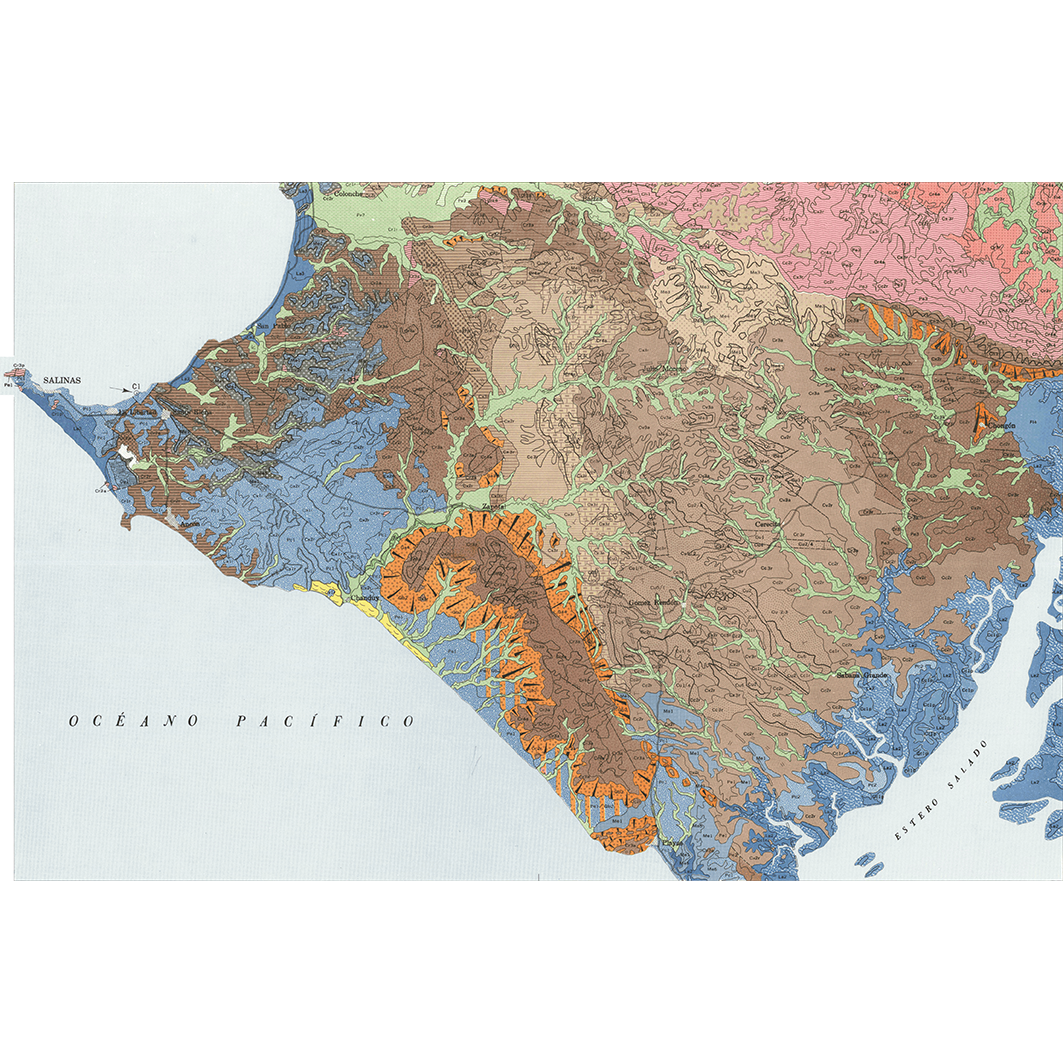
1. Salinas : carta geomorfologica. / MAG, Ministerio de agricultura y ganaderia, PRONAREG. Programa nacional de regionalizacion agraria; Scale of 1:200 000. Date of publication: 1978. (file: 00097RC_IRD_ECU_GMOR_1978_200000_IRD_ECU_GMOR_1978_200000.tif)
publicationDec 31, 1977
Temporal CoverageJan 1, 1978Dec 31, 1978
Overview
1 / 2
Lineage
1. Scanning to tif format, 256 colors, 250dpi.
2. Georeferencing and if possible reprojection to WGS84 (Longitude / Latitude).
3. Clipping and mosaicing of map sheets(s).
4. Export ECW format.
5. ECW to GeoTIFF format conversion.
2. Georeferencing and if possible reprojection to WGS84 (Longitude / Latitude).
3. Clipping and mosaicing of map sheets(s).
4. Export ECW format.
5. ECW to GeoTIFF format conversion.
Links
Downloads
- sphaera_ws:00097RC_IRD_ECU_GMOR_1978_200000_IRD_ECU_GMOR_1978_200000 Salinas : carta geomorfologica.
- link
Geolinks
- sphaera_ws:00097RC_IRD_ECU_GMOR_1978_200000_IRD_ECU_GMOR_1978_200000 Salinas : carta geomorfologica.
Others
- Link to Original Record [datasuds-geo.ird.fr] This metadata comes from datasuds-geo.ird.fr
- Digital Object Identifier (DOI)
Keywords
Constraints
licence
Use limitations
Licence : CC-BY-NC-SA