Équateur : mapa de formaciones vegetales y uso actual. Scale of 1:200 000. Date of publication: 1982-1984.
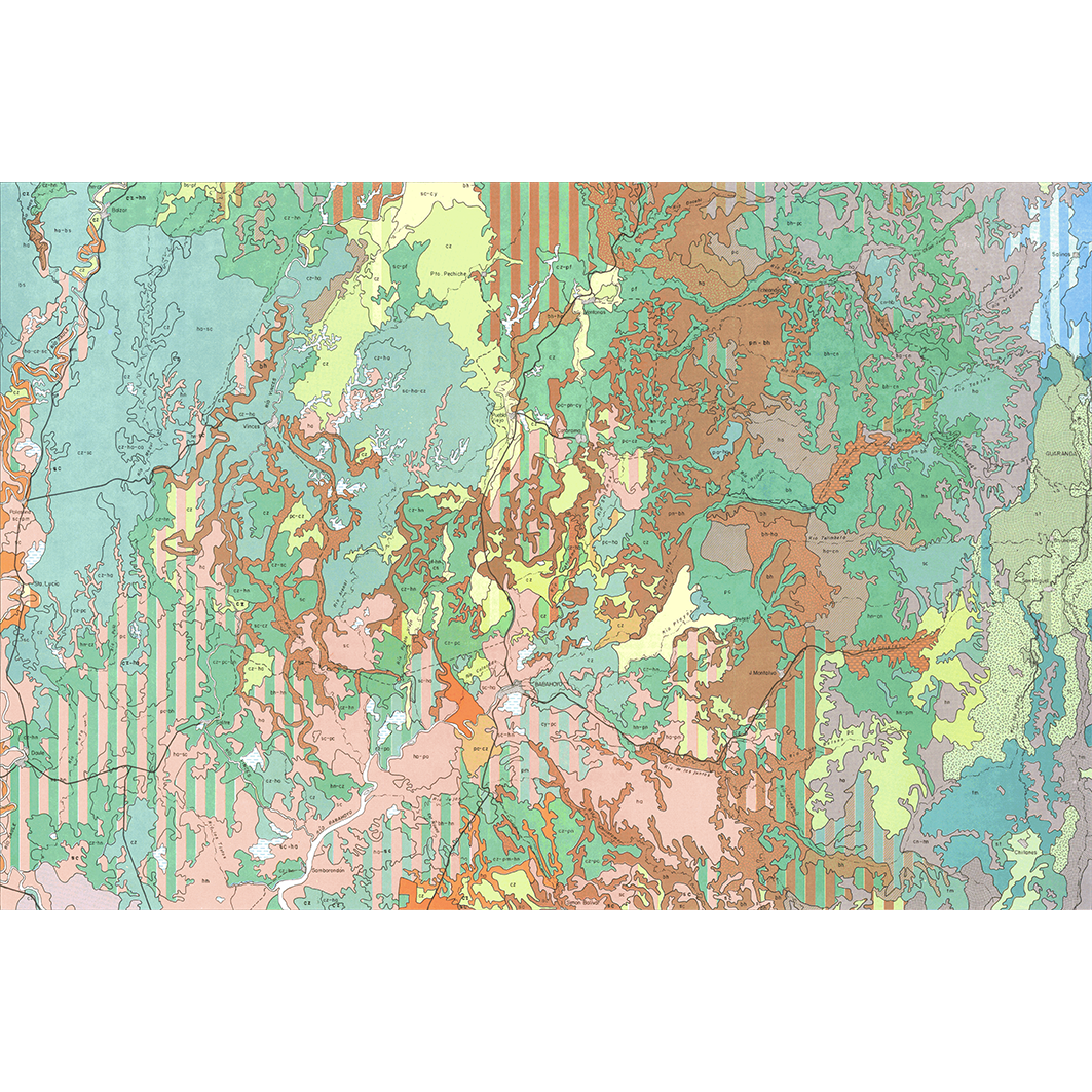
1. Babahoyo : mapa de formaciones vegetales y uso actual. / La Torre S., Patricio de; Miranda R., Jaime; Muñoz F., Alfredo; Tipantuña A., Gustavo; Winckell, A.; Zebrowski, C.; Zuñiga N., Marcelo; Scale of 1:200 000. Date of publication: 1984. (file: 02475RC_IRD_ECU_VEFO_1984_200000_IRD_ECU_VEFO_1982-84_200000.tif) 2. Bahia de Caraquez : mapa de formaciones vegetales y uso actual. / La Torre S., Patricio de; Muñoz F., Alfredo; Paredes D., Luis; Tipantuña A., Gustavo; Winckell, A.; Zebrowski, C.; Scale of 1:200 000. Date of publication: 1982. (file: 02490RC_IRD_ECU_VEFO_1982_200000_IRD_ECU_VEFO_1982-84_200000.tif) 3. Esmeraldas : mapa de formaciones vegetales y uso actual. / La Torre S., Patricio de; Benitez, Miguel E.; Manrique Y., Galo; Trujillo Y., German; Winckell, A.; Zebrowski, C.; Zuñiga N., Marcelo; Scale of 1:200 000. Date of publication: 1982. (file: 02484RC_IRD_ECU_VEFO_1982_200000_IRD_ECU_VEFO_1982-84_200000.tif) 4. Guayaquil : mapa de formaciones vegetales y uso actual. / La Torre S., Patricio de; Miranda R., Jaime; Muñoz F., Alfredo; Winckell, A.; Zebrowski, C.; Scale of 1:200 000. Date of publication: 1984. (file: 02478RC_IRD_ECU_VEFO_1984_200000_IRD_ECU_VEFO_1982-84_200000.tif) 5. Machala : mapa de formaciones vegetales y uso actual. / La Torre S., Patricio de; Calero J., Carlos; Huttel, Ch.; Winckell, A.; Zebrowski, C.; Zuñiga N., Marcelo; Scale of 1:200 000. Date of publication: 1983. (file: 02481RC_IRD_ECU_VEFO_1983_200000_IRD_ECU_VEFO_1982-84_200000.tif) 6. Muisne : mapa de formaciones vegetales y uso actual. / Manrique Y., Galo; Coronel A., Jaime; La Torre S., Patricio de; Muñoz F., Alfredo; Winckell, A.; Zebrowski, C.; Zuñiga N., Marcelo; Scale of 1:200 000. Date of publication: 1983. (file: 02487RC_IRD_ECU_VEFO_1983_200000_IRD_ECU_VEFO_1982-84_200000.tif) 7. Quevedo : mapa de formaciones vegetales y uso actual. / La Torre S., Patricio de; Huttel, Ch.; Miranda R., Jaime; Muñoz F., Alfredo; Tipantuña A., Gustavo; Winckell, A.; Zebrowski, C.; Zuñiga N., Marcelo; Scale of 1:200 000. Date of publication: 1984. (file: 02472RC_IRD_ECU_VEFO_1984_200000_IRD_ECU_VEFO_1982-84_200000.tif) 8. Quinindé : mapa de formaciones vegetales y uso actual. / Loaiza, César; La Torre S., Patricio de; Tipantuña A., Gustavo; Winckell, A.; Zebrowski, C.; Scale of 1:200 000. Date of publication: 1984. (file: 02466RC_IRD_ECU_VEFO_1984_200000_IRD_ECU_VEFO_1982-84_200000.tif) 9. Santo Domingo : mapa de formaciones vegetales y uso actual. / La Torre S., Patricio de; Huttel, Ch.; Miranda R., Jaime; Muñoz F., Alfredo; Tipantuña A., Gustavo; Winckell, A.; Zebrowski, C.; Zuñiga N., Marcelo; Scale of 1:200 000. Date of publication: 1983. (file: 02469RC_IRD_ECU_VEFO_1983_200000_IRD_ECU_VEFO_1982-84_200000.tif) 10. Valdez : mapa de formaciones vegetales y uso actual. / La Torre S., Patricio de; Miranda R., Jaime; Muñoz F., Alfredo; Winckell, A.; Zebrowski, C.; Zuñiga N., Marcelo; Scale of 1:200 000. Date of publication: 1984. (file: 02463RC_IRD_ECU_VEFO_1984_200000_IRD_ECU_VEFO_1982-84_200000.tif)
Overview
Lineage
2. Georeferencing and if possible reprojection to WGS84 (Longitude / Latitude).
3. Clipping and mosaicing of map sheets(s).
4. Export ECW format.
5. ECW to GeoTIFF format conversion.
Links
Downloads
- sphaera_ws:02475RC_IRD_ECU_VEFO_1984_200000_IRD_ECU_VEFO_1982-84_200000 Babahoyo : mapa de formaciones vegetales y uso actual.
- link
- sphaera_ws:02490RC_IRD_ECU_VEFO_1982_200000_IRD_ECU_VEFO_1982-84_200000 Bahia de Caraquez : mapa de formaciones vegetales y uso actual.
- Télécharger au format GeoTIFF Télécharger au format GeoTIFF
- sphaera_ws:02484RC_IRD_ECU_VEFO_1982_200000_IRD_ECU_VEFO_1982-84_200000 Esmeraldas : mapa de formaciones vegetales y uso actual.
- Télécharger au format GeoTIFF Télécharger au format GeoTIFF
- sphaera_ws:02478RC_IRD_ECU_VEFO_1984_200000_IRD_ECU_VEFO_1982-84_200000 Guayaquil : mapa de formaciones vegetales y uso actual.
- Télécharger au format GeoTIFF Télécharger au format GeoTIFF
- sphaera_ws:02481RC_IRD_ECU_VEFO_1983_200000_IRD_ECU_VEFO_1982-84_200000 Machala : mapa de formaciones vegetales y uso actual.
- Télécharger au format GeoTIFF Télécharger au format GeoTIFF
- sphaera_ws:02487RC_IRD_ECU_VEFO_1983_200000_IRD_ECU_VEFO_1982-84_200000 Muisne : mapa de formaciones vegetales y uso actual.
- Télécharger au format GeoTIFF Télécharger au format GeoTIFF
- sphaera_ws:02472RC_IRD_ECU_VEFO_1984_200000_IRD_ECU_VEFO_1982-84_200000 Quevedo : mapa de formaciones vegetales y uso actual.
- Télécharger au format GeoTIFF Télécharger au format GeoTIFF
- sphaera_ws:02466RC_IRD_ECU_VEFO_1984_200000_IRD_ECU_VEFO_1982-84_200000 Quinindé : mapa de formaciones vegetales y uso actual.
- Télécharger au format GeoTIFF Télécharger au format GeoTIFF
- sphaera_ws:02469RC_IRD_ECU_VEFO_1983_200000_IRD_ECU_VEFO_1982-84_200000 Santo Domingo : mapa de formaciones vegetales y uso actual.
- Télécharger au format GeoTIFF Télécharger au format GeoTIFF
- sphaera_ws:02463RC_IRD_ECU_VEFO_1984_200000_IRD_ECU_VEFO_1982-84_200000 Valdez : mapa de formaciones vegetales y uso actual.
- Télécharger au format GeoTIFF Télécharger au format GeoTIFF
Geolinks
- sphaera_ws:02475RC_IRD_ECU_VEFO_1984_200000_IRD_ECU_VEFO_1982-84_200000 Babahoyo : mapa de formaciones vegetales y uso actual.
- sphaera_ws:02490RC_IRD_ECU_VEFO_1982_200000_IRD_ECU_VEFO_1982-84_200000 Bahia de Caraquez : mapa de formaciones vegetales y uso actual.
- sphaera_ws:02484RC_IRD_ECU_VEFO_1982_200000_IRD_ECU_VEFO_1982-84_200000 Esmeraldas : mapa de formaciones vegetales y uso actual.
- sphaera_ws:02478RC_IRD_ECU_VEFO_1984_200000_IRD_ECU_VEFO_1982-84_200000 Guayaquil : mapa de formaciones vegetales y uso actual.
- sphaera_ws:02481RC_IRD_ECU_VEFO_1983_200000_IRD_ECU_VEFO_1982-84_200000 Machala : mapa de formaciones vegetales y uso actual.
- sphaera_ws:02487RC_IRD_ECU_VEFO_1983_200000_IRD_ECU_VEFO_1982-84_200000 Muisne : mapa de formaciones vegetales y uso actual.
- sphaera_ws:02472RC_IRD_ECU_VEFO_1984_200000_IRD_ECU_VEFO_1982-84_200000 Quevedo : mapa de formaciones vegetales y uso actual.
- sphaera_ws:02466RC_IRD_ECU_VEFO_1984_200000_IRD_ECU_VEFO_1982-84_200000 Quinindé : mapa de formaciones vegetales y uso actual.
- sphaera_ws:02469RC_IRD_ECU_VEFO_1983_200000_IRD_ECU_VEFO_1982-84_200000 Santo Domingo : mapa de formaciones vegetales y uso actual.
- sphaera_ws:02463RC_IRD_ECU_VEFO_1984_200000_IRD_ECU_VEFO_1982-84_200000 Valdez : mapa de formaciones vegetales y uso actual.
Others
- Link to Original Record [datasuds-geo.ird.fr] This metadata comes from datasuds-geo.ird.fr
- Digital Object Identifier (DOI)