Kinshasa, organisation urbaine. Scale of 1:50 000. Date of publication: 1975-1984.
IDS IRD
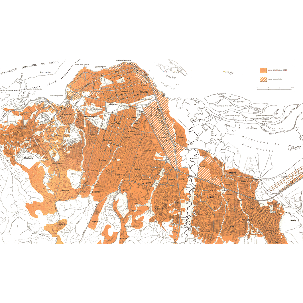
1. Carte de localisation. / Institut Géographique du Zaïre, Bureau d'Études d'Aménagements Urbains; Scale of 1:50 000. Date of publication: 1984. (file: 04821RC_IRD_ZAR_ESUR_1984_50000_IRD_ZAR_ESUR_1975-84_50000.tif) 2. Organisation urbaine. / Pain, Marc; Scale of 1:50 000. Date of publication: 1975. (file: 04820RC_IRD_ZAR_ESUR_1975_50000_IRD_ZAR_ESUR_1975-84_50000.tif)
publicationDec 31, 1974
Temporal CoverageJan 1, 1975Dec 31, 1984
Overview
1 / 2
Lineage
1. Scanning to tif format, 256 colors, 250dpi.
2. Georeferencing and if possible reprojection to WGS84 (Longitude / Latitude).
3. Clipping and mosaicing of map sheets(s).
4. Export ECW format.
5. ECW to GeoTIFF format conversion.
2. Georeferencing and if possible reprojection to WGS84 (Longitude / Latitude).
3. Clipping and mosaicing of map sheets(s).
4. Export ECW format.
5. ECW to GeoTIFF format conversion.
Links
Downloads
- sphaera_ws:04821RC_IRD_ZAR_ESUR_1984_50000_IRD_ZAR_ESUR_1975-84_50000 Carte de localisation.
- link
- sphaera_ws:04820RC_IRD_ZAR_ESUR_1975_50000_IRD_ZAR_ESUR_1975-84_50000 Organisation urbaine.
- Télécharger au format GeoTIFF Télécharger au format GeoTIFF
Geolinks
- sphaera_ws:04821RC_IRD_ZAR_ESUR_1984_50000_IRD_ZAR_ESUR_1975-84_50000 Carte de localisation.
- sphaera_ws:04820RC_IRD_ZAR_ESUR_1975_50000_IRD_ZAR_ESUR_1975-84_50000 Organisation urbaine.
Others
- Link to Original Record [datasuds-geo.ird.fr] This metadata comes from datasuds-geo.ird.fr
- Digital Object Identifier (DOI)
Keywords
Constraints
licence
Use limitations
Licence : CC-BY-NC-SA