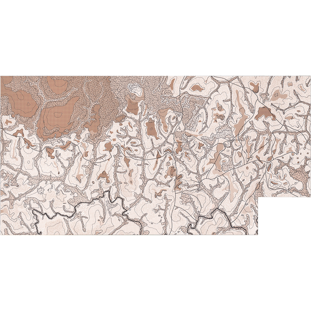
Carte géomorphologique : région du ranch de Sipilou. Scale of 1:25 000. Date of publication: 1976.
IDS IRD
1. Carte géomorphologique : région du ranch de Sipilou. / Avenard, Jean Michel; Maurer, A. (ill.); Scale of 1:25 000. Date of publication: 1976. (file: 00897RC_IRD_CIV_GMOR_1976_25000_IRD_CIV_GMOR_1976_25000.tif)
publicationDec 31, 1975
Temporal CoverageJan 1, 1976Dec 31, 1976
Overview
1 / 2
Lineage
1. Scanning to tif format, 256 colors, 250dpi.
2. Georeferencing and if possible reprojection to WGS84 (Longitude / Latitude).
3. Clipping and mosaicing of map sheets(s).
4. Export ECW format.
5. ECW to GeoTIFF format conversion.
2. Georeferencing and if possible reprojection to WGS84 (Longitude / Latitude).
3. Clipping and mosaicing of map sheets(s).
4. Export ECW format.
5. ECW to GeoTIFF format conversion.
Links
Downloads
- sphaera_ws:00897RC_IRD_CIV_GMOR_1976_25000_IRD_CIV_GMOR_1976_25000 Carte géomorphologique : région du ranch de Sipilou.
- link
Geolinks
- sphaera_ws:00897RC_IRD_CIV_GMOR_1976_25000_IRD_CIV_GMOR_1976_25000 Carte géomorphologique : région du ranch de Sipilou.
Others
- Notice explicative ou autre ouvrage Document associé à la carte
- Link to Original Record [datasuds-geo.ird.fr] This metadata comes from datasuds-geo.ird.fr
- Digital Object Identifier (DOI)
Keywords
Constraints
licence
Use limitations
Licence : CC-BY-NC-SA