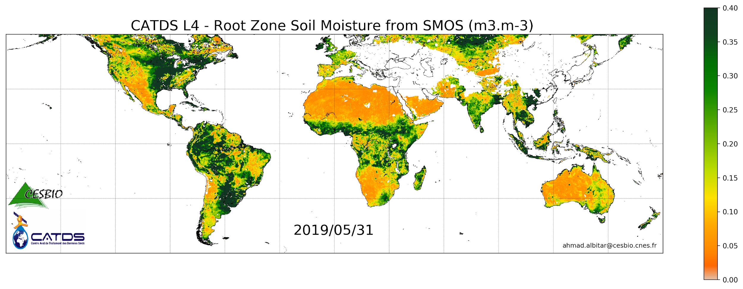
CATDS-PDC L4SM RZSM - 1 day global map of root zone soil moisture values from SMOS satellite
This product is a daily product of root zone soil moisture representative of the 0-1 m depth of the soil. The base products, for all the CATDS-PDC (Centre Aval de Traitement des Données SMOS - Production & Dissemination Center) processing chains, are the SMOS L1B products from ESA (European Space Agency). The L4SM RZSM is the daily product of root zone soil moisture (m3/m3) representative of the 0-1 m depth of the soil. The product contains also a quality index taking into account the presence of Radio Frequency Interference (RFI), low quality of retrieval of the input surface soil moisture, and a high fraction of non-nominal surfaces. Products from reprocessing RE07 are available for the period 01/2010 - 05/2021. Products from operational (OPER) processing are available since 06/2021. Reprocessed products and operational products are derived using the same algorithm and configuration, hence ensuring the temporal continuity.
Overview
Lineage
Links
Downloads
- FTP Access FTP Access - All products are also available by ftp : server ftp.ifremer.fr, login ext-catds-cpdc, passwd catds2010, path Land_products/GRIDDED/... (same paths as in above https links)
- Ifremer HTTPS Access
- Ifremer FTP Access FTP
Geolinks
- No links available
Others
- Processing and validation Al Bitar Ahmad, & Mahmoodi Ali. (2020, November 30). Algorithm Theoretical Basis Document (ATBD) for the SMOS Level 4 Root Zone Soil Moisture (Version v30_01). Zenodo. http://doi.org/10.5281/zenodo.4298572
- Product notices List of products, user manuals and algorithms documents:
- Link to Original Record [www.catds.fr] This metadata comes from www.catds.fr
- Digital Object Identifier (DOI)