Cameroun : plateaux de l'ouest. Scale of 1:2 000 000 to 1:50 000. Date of publication: 1986-1991.
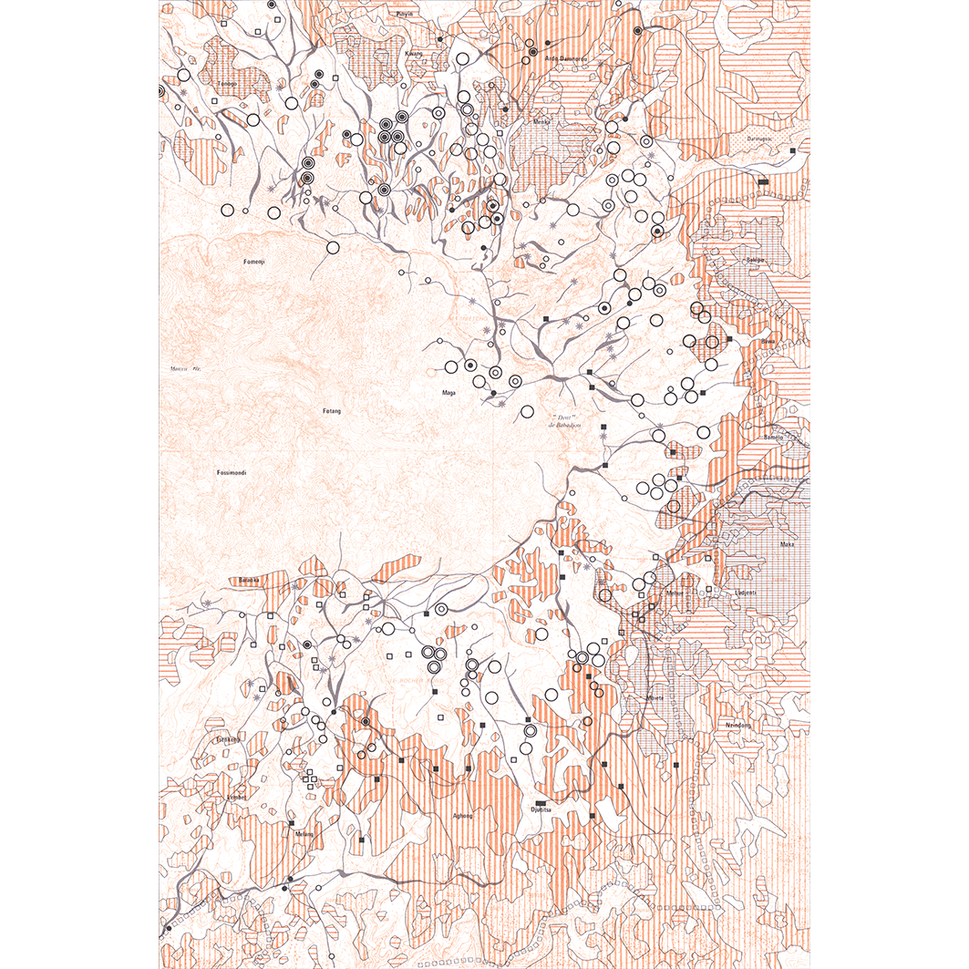
1. Cameroun : Monts Bambouto : évolution de l'occupation du sol : carte N°7. / Boutrais, Jean; Scale of 1:50 000. Date of publication: 1989. (file: 01409RC_IRD_CMR_USOL_1989_50000_IRD_CMR_CSRE_1986-91_2000000-50000.tif) 2. Cameroun : Monts Bambouto : végétation de la zone d'élevage : carte No 3. / Boutrais, Jean; Weiss, S. (ill.); Scale of 1:50 000. Date of publication: 1990. (file: 01405RC_IRD_CMR_VEGE_1990_50000_IRD_CMR_CSRE_1986-91_2000000-50000.tif) 3. Cameroun : plateaux de l'ouest : carte de repérage : carte N°2. / Boutrais, Jean; Weiss, S. (ill.); Scale of 1:270 270. Date of publication: 1991. (file: 01404RC_IRD_CMR_ILSI_1991_270270_IRD_CMR_CSRE_1986-91_2000000-50000.tif) 4. Cameroun : plateaux de l'ouest : culture du café et élevage paysan : carte No 4. / Boutrais, Jean; Weiss, S. (collab.) Scale of 1:270 270. Date of publication: 1986. (file: 01406RC_IRD_CMR_AGCE_1986_270270_IRD_CMR_CSRE_1986-91_2000000-50000.tif) 5. Cameroun : plateaux de l'ouest : élevage paysan et cultures vivrières masculines : carte No 5. / Boutrais, Jean; Weiss, S. (collab.) Scale of 1:270 270. Date of publication: 1986. (file: 01407RC_IRD_CMR_AGCU_1986_270270_IRD_CMR_CSRE_1986-91_2000000-50000.tif) 6. Cameroun : plateaux de l'ouest : encombrement de l'espace par les hommes et le bétail en 1975 : carte N°6. / Boutrais, Jean; Weiss, S. (ill.); Scale of 1:270 270. Date of publication: 1988. (file: 01408RC_IRD_CMR_USOL_1988_270270_IRD_CMR_CSRE_1986-91_2000000-50000.tif) 7. Cameroun : plateaux de l'ouest : fixation des Mbororo en saison des pluies : carte N°8. / Boutrais, Jean; Weiss, S. (collab.) Scale of 1:270 270. Date of publication: 1986. (file: 01410RC_IRD_CMR_POEL_1986_270270_IRD_CMR_CSRE_1986-91_2000000-50000.tif) 8. Cameroun : plateaux de l'ouest : transhumance de saison sèche : déplacements du cheptel en 1974 : carte N°9. / Boutrais, Jean; Weiss, S. (ill.); Scale of 1:270 270. Date of publication: 1986. (file: 01411RC_IRD_CMR_AGEL_1986_270270_IRD_CMR_CSRE_1986-91_2000000-50000.tif) 9. Cameroun : plateaux de l'ouest : transhumance de saison sèche : transferts du cheptel en altitude en 1974 : carte N°10. / Boutrais, Jean; Weiss, S. (ill.); Scale of 1:270 270. Date of publication: 1986. (file: 01412RC_IRD_CMR_AGEL_1986_270270_IRD_CMR_CSRE_1986-91_2000000-50000.tif) 10. Hautes terres de la Dorsale Camerounaise : carte N°1. / Boutrais, Jean; Weiss, S. (ill.); Olivry, J. C. (collab.) Scale of 1:2 000 000. Date of publication: 1991. (file: 01403RC_IRD_CMR_EVPH_1991_2000000_IRD_CMR_CSRE_1986-91_2000000-50000.tif)
Overview
Lineage
2. Georeferencing and if possible reprojection to WGS84 (Longitude / Latitude).
3. Clipping and mosaicing of map sheets(s).
4. Export ECW format.
5. ECW to GeoTIFF format conversion.
Links
Downloads
- sphaera_ws:01409RC_IRD_CMR_USOL_1989_50000_IRD_CMR_CSRE_1986-91_2000000-50000 Cameroun : Monts Bambouto : évolution de l'occupation du sol : carte N°7.
- link
- sphaera_ws:01405RC_IRD_CMR_VEGE_1990_50000_IRD_CMR_CSRE_1986-91_2000000-50000 Cameroun : Monts Bambouto : végétation de la zone d'élevage : carte No 3.
- Télécharger au format GeoTIFF Télécharger au format GeoTIFF
- sphaera_ws:01404RC_IRD_CMR_ILSI_1991_270270_IRD_CMR_CSRE_1986-91_2000000-50000 Cameroun : plateaux de l'ouest : carte de repérage : carte N°2.
- Télécharger au format GeoTIFF Télécharger au format GeoTIFF
- sphaera_ws:01406RC_IRD_CMR_AGCE_1986_270270_IRD_CMR_CSRE_1986-91_2000000-50000 Cameroun : plateaux de l'ouest : culture du café et élevage paysan : carte No 4.
- Télécharger au format GeoTIFF Télécharger au format GeoTIFF
- sphaera_ws:01407RC_IRD_CMR_AGCU_1986_270270_IRD_CMR_CSRE_1986-91_2000000-50000 Cameroun : plateaux de l'ouest : élevage paysan et cultures vivrières masculines : carte No 5.
- Télécharger au format GeoTIFF Télécharger au format GeoTIFF
- sphaera_ws:01408RC_IRD_CMR_USOL_1988_270270_IRD_CMR_CSRE_1986-91_2000000-50000 Cameroun : plateaux de l'ouest : encombrement de l'espace par les hommes et le bétail en 1975 : carte N°6.
- Télécharger au format GeoTIFF Télécharger au format GeoTIFF
- sphaera_ws:01410RC_IRD_CMR_POEL_1986_270270_IRD_CMR_CSRE_1986-91_2000000-50000 Cameroun : plateaux de l'ouest : fixation des Mbororo en saison des pluies : carte N°8.
- Télécharger au format GeoTIFF Télécharger au format GeoTIFF
- sphaera_ws:01411RC_IRD_CMR_AGEL_1986_270270_IRD_CMR_CSRE_1986-91_2000000-50000 Cameroun : plateaux de l'ouest : transhumance de saison sèche : déplacements du cheptel en 1974 : carte N°9.
- Télécharger au format GeoTIFF Télécharger au format GeoTIFF
- sphaera_ws:01412RC_IRD_CMR_AGEL_1986_270270_IRD_CMR_CSRE_1986-91_2000000-50000 Cameroun : plateaux de l'ouest : transhumance de saison sèche : transferts du cheptel en altitude en 1974 : carte N°10.
- Télécharger au format GeoTIFF Télécharger au format GeoTIFF
- sphaera_ws:01403RC_IRD_CMR_EVPH_1991_2000000_IRD_CMR_CSRE_1986-91_2000000-50000 Hautes terres de la Dorsale Camerounaise : carte N°1.
- Télécharger au format GeoTIFF Télécharger au format GeoTIFF
Geolinks
- sphaera_ws:01409RC_IRD_CMR_USOL_1989_50000_IRD_CMR_CSRE_1986-91_2000000-50000 Cameroun : Monts Bambouto : évolution de l'occupation du sol : carte N°7.
- sphaera_ws:01405RC_IRD_CMR_VEGE_1990_50000_IRD_CMR_CSRE_1986-91_2000000-50000 Cameroun : Monts Bambouto : végétation de la zone d'élevage : carte No 3.
- sphaera_ws:01404RC_IRD_CMR_ILSI_1991_270270_IRD_CMR_CSRE_1986-91_2000000-50000 Cameroun : plateaux de l'ouest : carte de repérage : carte N°2.
- sphaera_ws:01406RC_IRD_CMR_AGCE_1986_270270_IRD_CMR_CSRE_1986-91_2000000-50000 Cameroun : plateaux de l'ouest : culture du café et élevage paysan : carte No 4.
- sphaera_ws:01407RC_IRD_CMR_AGCU_1986_270270_IRD_CMR_CSRE_1986-91_2000000-50000 Cameroun : plateaux de l'ouest : élevage paysan et cultures vivrières masculines : carte No 5.
- sphaera_ws:01408RC_IRD_CMR_USOL_1988_270270_IRD_CMR_CSRE_1986-91_2000000-50000 Cameroun : plateaux de l'ouest : encombrement de l'espace par les hommes et le bétail en 1975 : carte N°6.
- sphaera_ws:01410RC_IRD_CMR_POEL_1986_270270_IRD_CMR_CSRE_1986-91_2000000-50000 Cameroun : plateaux de l'ouest : fixation des Mbororo en saison des pluies : carte N°8.
- sphaera_ws:01411RC_IRD_CMR_AGEL_1986_270270_IRD_CMR_CSRE_1986-91_2000000-50000 Cameroun : plateaux de l'ouest : transhumance de saison sèche : déplacements du cheptel en 1974 : carte N°9.
- sphaera_ws:01412RC_IRD_CMR_AGEL_1986_270270_IRD_CMR_CSRE_1986-91_2000000-50000 Cameroun : plateaux de l'ouest : transhumance de saison sèche : transferts du cheptel en altitude en 1974 : carte N°10.
- sphaera_ws:01403RC_IRD_CMR_EVPH_1991_2000000_IRD_CMR_CSRE_1986-91_2000000-50000 Hautes terres de la Dorsale Camerounaise : carte N°1.
Others
- Notice explicative ou autre ouvrage Document associé à la carte
- Link to Original Record [datasuds-geo.ird.fr] This metadata comes from datasuds-geo.ird.fr
- Notice explicative ou autre ouvrage Document associé à la carte
- Notice explicative ou autre ouvrage Document associé à la carte
- Notice explicative ou autre ouvrage Document associé à la carte
- Notice explicative ou autre ouvrage Document associé à la carte
- Notice explicative ou autre ouvrage Document associé à la carte
- Notice explicative ou autre ouvrage Document associé à la carte
- Notice explicative ou autre ouvrage Document associé à la carte
- Notice explicative ou autre ouvrage Document associé à la carte
- Notice explicative ou autre ouvrage Document associé à la carte
- Digital Object Identifier (DOI)