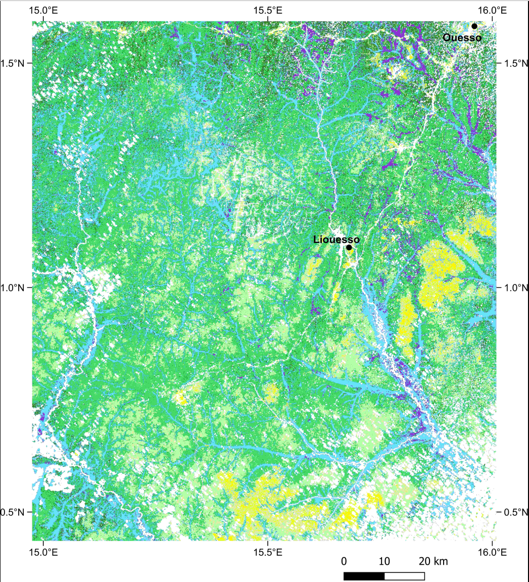
Map of vegetation types in the North of the Republic of Congo
Tropical moist forests are not the homogeneous green carpet often illustrated in maps or considered by global models. They harbour a complex mixture of forest types organised at different spatial scales. In this study we built a large-scale vegetation map of the North of Congo and assessed the environmental drivers of the main forest types, their forest structure, their floristic and functional compositions, and their faunistic composition. To build the map, we used Sentinel-2 satellite images and recent deep learning architectures. The dataset consist in a map of six vegetation types over 18 500 km² in the North of the Republic of Congo: dense forests, swamp forests, secondary forests, monodominant Gilbertiodendron forests, Marantaceae forests, open Marantaceae forests.
Overview
Lineage
Links
Downloads
- VegTypesMap_NCongo_2024 Vegetation types in the North of the Congo - 2024.
- Vegetation types in the North of the Congo - 2024.
- Legend_of_vegetation_types.pdf Legend of the vegetation types
- VegTypesMap_NCongo_2024.sld Symbology file in SLD format to be associated with the raster layer.
Geolinks
- VegTypesMap_NCongo_2024 Vegetation types in the North of the Congo - 2024.
Others
- Publication associée Combining satellite and field data reveals Congo's forest types structure, functioning and composition. [in preparation].
- Link to Original Record [datasuds-geo.ird.fr] This metadata comes from datasuds-geo.ird.fr