Un espace sahélien : la mare d'Oursi, Burkina Faso. Scale of 1:50 000. Date of publication: 1985-1991.
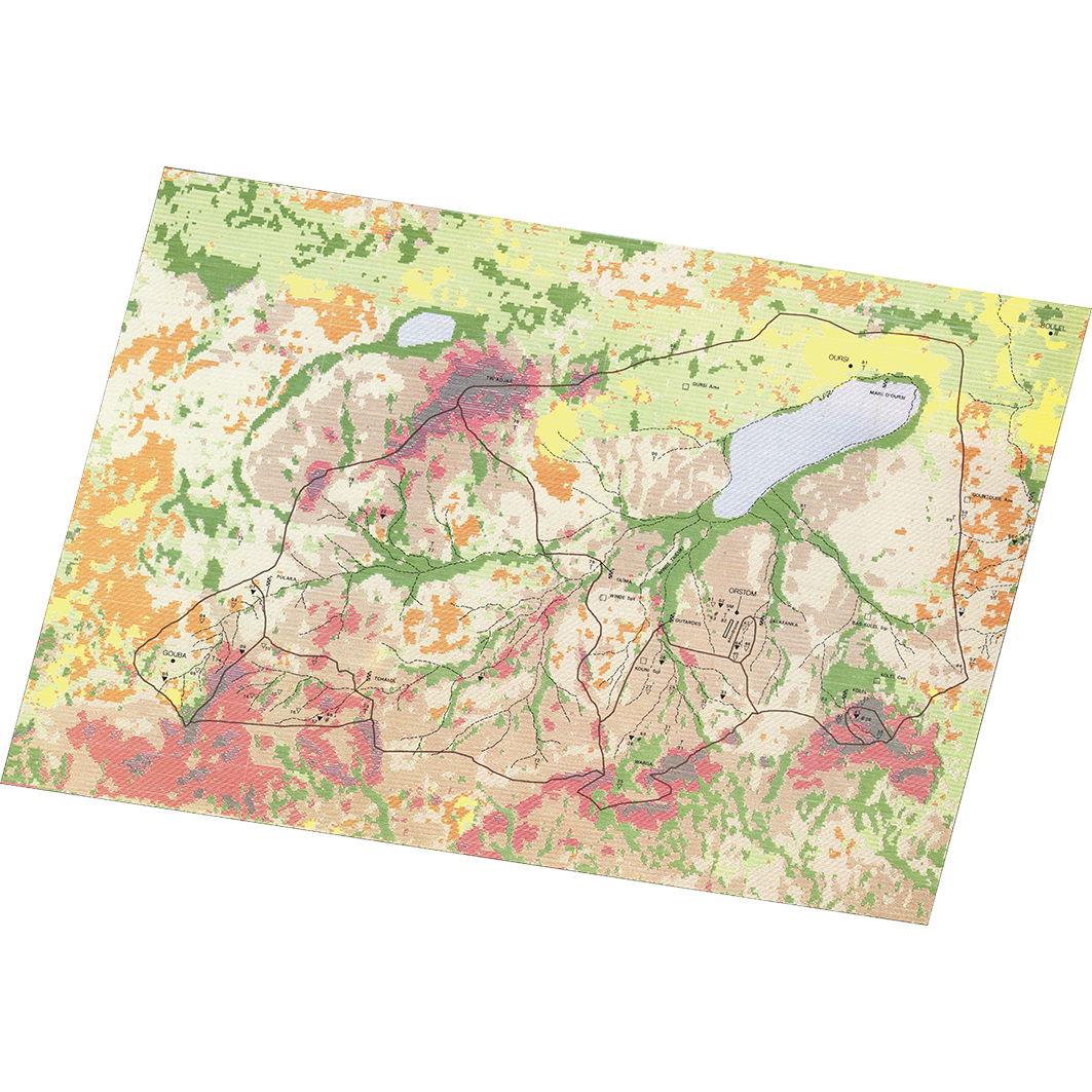
1. Carte 1 : bassin versant de la mare d'oursi (Burkina Faso) : différenciation des états de surface (image Landsat du 4-2-1976). / Chevallier, P.; Lointier, Marc; Lortic, Bernard; Suavin, M. (ill.); Équipements de mesures. Scale of 1:50 000. Date of publication: 1985. (file: 01431RC_IRD_BFA_USOL_1985_50000_IRD_BFA_CSRE_1985-91_50000.tif) 2. Carte 2 : bassin versant de la mare d'oursi (Burkina) : différenciation des états de surface (classification multispectrale de l'image donnée par le satellite Landsat le 4 février 1976). / Chevallier, P.; Lointier, Marc; Lortic, Bernard; Scale of 1:50 000. Date of publication: 1985. (file: 13842RC_IRD_BFA_USOL_1985_50000_IRD_BFA_CSRE_1985-91_50000.tif) 3. Carte 3 : carte géomorphologique et géodynamique du bassin de la mare d'Oursi (Burkina Faso). / Joly, F.; Dewolf, Y.; Ducousso, M. (ill.); Sevestre, A. (ill.); Scale of 1:50 000. Date of publication: 1991. (file: 01432RC_IRD_BFA_GMOR_1991_50000_IRD_BFA_CSRE_1985-91_50000.tif)
Overview
Lineage
2. Georeferencing and if possible reprojection to WGS84 (Longitude / Latitude).
3. Clipping and mosaicing of map sheets(s).
4. Export ECW format.
5. ECW to GeoTIFF format conversion.
Links
Downloads
- sphaera_ws:01431RC_IRD_BFA_USOL_1985_50000_IRD_BFA_CSRE_1985-91_50000 Carte 1 : bassin versant de la mare d'oursi (Burkina Faso) : différenciation des états de surface (image Landsat du 4-2-1976).
- link
- sphaera_ws:13842RC_IRD_BFA_USOL_1985_50000_IRD_BFA_CSRE_1985-91_50000 Carte 2 : bassin versant de la mare d'oursi (Burkina) : différenciation des états de surface (classification multispectrale de l'image donnée par le satellite Landsat le 4 février 1976).
- Télécharger au format GeoTIFF Télécharger au format GeoTIFF
- sphaera_ws:01432RC_IRD_BFA_GMOR_1991_50000_IRD_BFA_CSRE_1985-91_50000 Carte 3 : carte géomorphologique et géodynamique du bassin de la mare d'Oursi (Burkina Faso).
- Télécharger au format GeoTIFF Télécharger au format GeoTIFF
Geolinks
- sphaera_ws:01431RC_IRD_BFA_USOL_1985_50000_IRD_BFA_CSRE_1985-91_50000 Carte 1 : bassin versant de la mare d'oursi (Burkina Faso) : différenciation des états de surface (image Landsat du 4-2-1976).
- sphaera_ws:13842RC_IRD_BFA_USOL_1985_50000_IRD_BFA_CSRE_1985-91_50000 Carte 2 : bassin versant de la mare d'oursi (Burkina) : différenciation des états de surface (classification multispectrale de l'image donnée par le satellite Landsat le 4 février 1976).
- sphaera_ws:01432RC_IRD_BFA_GMOR_1991_50000_IRD_BFA_CSRE_1985-91_50000 Carte 3 : carte géomorphologique et géodynamique du bassin de la mare d'Oursi (Burkina Faso).
Others
- Notice explicative ou autre ouvrage Document associé à la carte
- Link to Original Record [datasuds-geo.ird.fr] This metadata comes from datasuds-geo.ird.fr
- Notice explicative ou autre ouvrage Document associé à la carte
- Notice explicative ou autre ouvrage Document associé à la carte
- Digital Object Identifier (DOI)