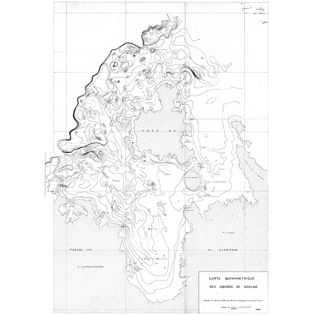
Carte bathymétrique des abords de Nosy Bé et Nosy Faly aux îles Mitsio. Scale of 1:100 300. Date of publication: unknown.
IDS IRD
1. Carte bathymétrique des abords de Nosy Bé. / ORSTOM, Office de la recherche scientifique et technique outre-mer, Centre de Nosy Bé, Laboratoire de géologie; Scale of 1:100 300. Date of publication: unknown. (file: 05339RC_IRD_MDG_BAME_----_100300_IRD_MDG_BAME_----_100300.tif) 2. De Nosy Faly aux îles Mitsio : carte bathymétrique. / ORSTOM, Office de la recherche scientifique et technique outre-mer, Centre de Nosy Bé, Laboratoire de géologie; Scale of 1:100 300. Date of publication: unknown. (file: 05338RC_IRD_MDG_BAME_----_100300_IRD_MDG_BAME_----_100300.tif)
publicationDec 31, 1000
Temporal CoverageJan 1, 1001Jan 1, 1001
Overview
1 / 4
Lineage
1. Scanning to tif format, 256 colors, 250dpi.
2. Georeferencing and if possible reprojection to WGS84 (Longitude / Latitude).
3. Clipping and mosaicing of map sheets(s).
4. Export ECW format.
5. ECW to GeoTIFF format conversion.
2. Georeferencing and if possible reprojection to WGS84 (Longitude / Latitude).
3. Clipping and mosaicing of map sheets(s).
4. Export ECW format.
5. ECW to GeoTIFF format conversion.
Links
Downloads
- sphaera_ws:05339RC_IRD_MDG_BAME_----_100300_IRD_MDG_BAME_----_100300 Carte bathymétrique des abords de Nosy Bé.
- link
- sphaera_ws:05338RC_IRD_MDG_BAME_----_100300_IRD_MDG_BAME_----_100300 De Nosy Faly aux îles Mitsio : carte bathymétrique.
- Télécharger au format GeoTIFF Télécharger au format GeoTIFF
Geolinks
- sphaera_ws:05339RC_IRD_MDG_BAME_----_100300_IRD_MDG_BAME_----_100300 Carte bathymétrique des abords de Nosy Bé.
- sphaera_ws:05338RC_IRD_MDG_BAME_----_100300_IRD_MDG_BAME_----_100300 De Nosy Faly aux îles Mitsio : carte bathymétrique.
Others
- Link to Original Record [datasuds-geo.ird.fr] This metadata comes from datasuds-geo.ird.fr
- Digital Object Identifier (DOI)
Keywords
Constraints
licence
Use limitations
Licence : CC-BY-NC-SA