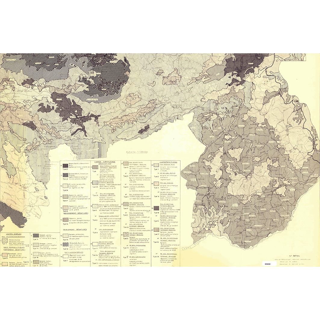
Carte pédologique du sud-ouest du Congo : Dolisie, Brazzaville, zone Kinkala - Madingou. Scale of 1:200 000. Date of publication: 1970.
IDS IRD
1. Carte pédologique du sud-est du Congo : zone Kinkala Madingou. / Denis, B.; Batila, Georges (ill.); Scale of 1:200 000. Date of publication: 1970. (file: 05830RC_IRD_COG_PEDO_1970_200000_IRD_COG_PEDO_1970_200000.tif) 2. Carte pédologique du sud-ouest du Congo : feuille de Dolisie. / Jamet, R.; Batila, Georges (ill.); Rieffel, J. M.; Scale of 1:200 000. Date of publication: unknown. (file: 05829RC_IRD_COG_PEDO_----_200000_IRD_COG_PEDO_1970_200000.tif) 3. Carte pédologique du sud du Congo : feuille de Brazzaville. / Denis, B.; Batila, Georges (ill.); Scale of 1:200 000. Date of publication: unknown. (file: 05831RC_IRD_COG_PEDO_----_200000_IRD_COG_PEDO_1970_200000.tif)
publicationDec 31, 1969
Temporal CoverageJan 1, 1970Dec 31, 1970
Overview
1 / 5
Lineage
1. Scanning to tif format, 256 colors, 250dpi.
2. Georeferencing and if possible reprojection to WGS84 (Longitude / Latitude).
3. Clipping and mosaicing of map sheets(s).
4. Export ECW format.
5. ECW to GeoTIFF format conversion.
2. Georeferencing and if possible reprojection to WGS84 (Longitude / Latitude).
3. Clipping and mosaicing of map sheets(s).
4. Export ECW format.
5. ECW to GeoTIFF format conversion.
Links
Downloads
- sphaera_ws:05830RC_IRD_COG_PEDO_1970_200000_IRD_COG_PEDO_1970_200000 Carte pédologique du sud-est du Congo : zone Kinkala Madingou.
- link
- sphaera_ws:05829RC_IRD_COG_PEDO_----_200000_IRD_COG_PEDO_1970_200000 Carte pédologique du sud-ouest du Congo : feuille de Dolisie.
- Télécharger au format GeoTIFF Télécharger au format GeoTIFF
- sphaera_ws:05831RC_IRD_COG_PEDO_----_200000_IRD_COG_PEDO_1970_200000 Carte pédologique du sud du Congo : feuille de Brazzaville.
- Télécharger au format GeoTIFF Télécharger au format GeoTIFF
Geolinks
- sphaera_ws:05830RC_IRD_COG_PEDO_1970_200000_IRD_COG_PEDO_1970_200000 Carte pédologique du sud-est du Congo : zone Kinkala Madingou.
- sphaera_ws:05829RC_IRD_COG_PEDO_----_200000_IRD_COG_PEDO_1970_200000 Carte pédologique du sud-ouest du Congo : feuille de Dolisie.
- sphaera_ws:05831RC_IRD_COG_PEDO_----_200000_IRD_COG_PEDO_1970_200000 Carte pédologique du sud du Congo : feuille de Brazzaville.
Others
- Link to Original Record [datasuds-geo.ird.fr] This metadata comes from datasuds-geo.ird.fr
- Digital Object Identifier (DOI)
Keywords
Constraints
licence
Use limitations
Licence : CC-BY-NC-SA