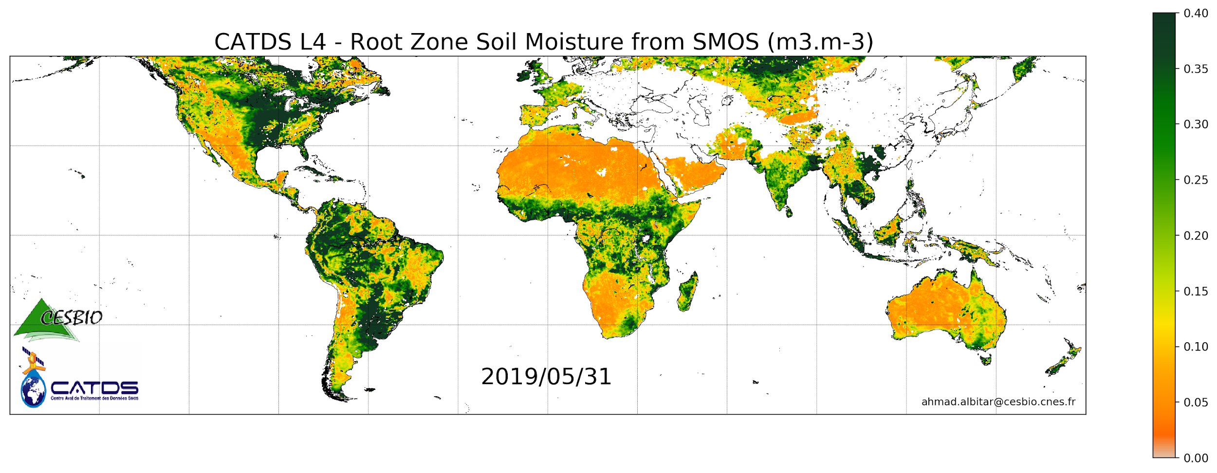
CATDS-PDC L4SM RZSM - 1 day global map of root zone soil moisture values from SMOS satellite
CATDS

This product is a daily product of root zone soil moisture representative of the 0-1 m depth of the soil.
publicationDec 6, 2022
Temporal CoverageJan 17, 2010
Overview

1 / 2
Lineage
The base products, for all the CATDS-PDC (Centre Aval de Traitement des Données SMOS - Production & Dissemination Center) processing chains, are the SMOS L1B products - https://doi.org/10.57780/SM1-e20cf57 - from ESA (European Space Agency).
The L4SM RZSM is the daily product of root zone soil moisture (m3/m3) representative of the 0-1 m depth of the soil. The product contains also a quality index taking into account the presence of Radio Frequency Interference (RFI), low quality of retrieval of the input surface soil moisture, and a high fraction of non-nominal surfaces.
Products from reprocessing RE07 are available for the period 01/2010 - 05/2021. Products from operational (OPER) processing are available since 06/2021. Reprocessed products and operational products are derived using the same algorithm and configuration, hence ensuring the temporal continuity.
File naming :
SM_clas_MIR_CLF4Rx_startdate_enddate_vvv_ccc_7
- clas : File class (OPER : operational mode, REXX : reprocessing xx)
- x : A for ascending orbit, D for descending orbit
- startdate : sensing start date/time of the data (format yyyymmddThhmiss)
- enddate : sensing end date/time of the data (format yyyymmddThhmiss)
- vvv : version number of the processor generating the product
- ccc : file counter
File format :
In each archive file (.tgz extension), there are two files
- A Header file (.HDR), which is a text file, in XML Earth Explorer Header format
- A Data file (.DBL.nc), which is a netcdf file, format variant 2 (netcdf 3 with 64 bits offset option)
Links
Downloads
- OPER-DESC OPER-DESC - Operational products (06/2021 - now), descending orbits
- FTP Access FTP Access - All products are also available by ftp : server ftp.ifremer.fr, login ext-catds-cpdc, passwd catds2010, path Land_products/GRIDDED/... (same paths as in above https links)
- OPER-ASC OPER-ASC - Operational products (06/2021 - now), ascending orbits
- RE07-ASC RE07-ASC - Reprocessed products (01/2010 - 05/202), ascending orbits
- RE07-DESC RE07-DESC - Reprocessed products (01/2010 - 05/202), descending orbits
Geolinks
- No links available
Others
- Link to Original Record [www.catds.fr] This metadata comes from www.catds.fr
- ATBD L4SM RZSM
- DOI of the dataset
- Reference Al Bitar Ahmad, & Mahmoodi Ali. (2020, November 30). Algorithm Theoretical Basis Document (ATBD) for the SMOS Level 4 Root Zone Soil Moisture (Version v30_01). Zenodo. http://doi.org/10.5281/zenodo.4298572 ;
- Publication N. Ojha, A. Mahmoodi, A. Mialon, P. Richaume, S. Ferrant and Y. H. Kerr, "Assessment of SMOS Root Zone Soil Moisture: A Comparative Study Using SMAP, ERA5, and GLDAS," in IEEE Access, vol. 12, pp. 76121-76132, 2024, https://doi.org/10.1109/ACCESS.2024.3404123 ;
- CATDS Web portal
Contacts
CATDS
CESBIO
CATDS (CNES, IFREMER, CESBIO)
Keywords
Constraints
License
Use limitations
Creative Commons license to apply : Attribution (BY) : http://creativecommons.org/licenses/?lang=en